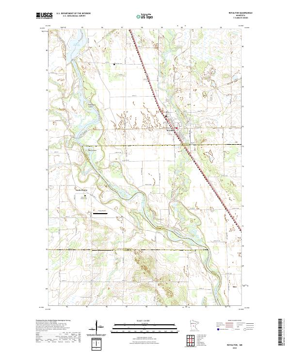
2022 Map of Royalton
USGS Topo · Published 2022About this map
Royalton serves as the central hub of this Central Minnesota landscape, situated where the Platte River meanders toward its confluence with the Mississippi River. This modern survey reveals a complex network of county roads and township lines that define the rural character of Morrison, Benton, and Stearns counties. The western edge is dominated by the Mississippi River corridor, featuring notable landforms like McDougall Island and Pasch Island, along with the Zebulon Pike Lake area. For family historians, the map is particularly dense with cemetery records, documenting sites such as Pioneer Cem, Royalton Cem, and the Holy Cross Church Cem near the settlement of North Prairie. The presence of Fussy Airport and the southern reach toward Rice indicate the continued development of this river-valley region, where traditional agricultural townships meet the infrastructure of the Great River Rd.
Find a feature on this map
100 named features on this map. Tap any name to fly to it.
Don’t see what you’re looking for? This feature index may not catch every label — zoom into the map to look around manually.
Map Details
Editions of this 2022 Royalton Map
This is the sole edition of this map. No revisions or reprints were ever made.
Other maps of this area

1948 · Pierz
USGS Topo · 1:62,500

1948 · Little Falls
USGS Topo · 1:62,500

1950 · Little Falls
USGS Topo · 1:62,500

1950 · Pierz
USGS Topo · 1:62,500

1950 · St. Cloud
USGS Topo · 1:62,500

1953 · Saint Cloud
USGS Topo · 1:250,000

1957 · Saint Cloud
USGS Topo · 1:250,000

1958 · Saint Cloud
USGS Topo · 1:250,000

1965 · St Stephen
USGS Topo · 1:24,000

1965 · Holdingford
USGS Topo · 1:24,000