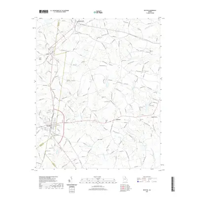
2020 Map of Royston
USGS Topo · Published 2020About this map
Royston serves as a central hub in this Northeast Georgia landscape where Franklin, Hart, and Madison counties converge. The area is defined by a dense network of rural roads connecting small settlements like Bowersville, Canon, and Goldmine. Local history and genealogy are anchored by numerous community sites, including Rose Hill Cem, Macedonia Ch, and the Old Hendry Cem near Eagle Grove. Water sources such as Beaverdam Cr, Brooks Lake, and Wilders Pond snake through the terrain, supporting the agricultural and residential life of the region. The presence of the Franklin County Airport indicates modern transportation development alongside traditional land use patterns. This survey provides a clear view of the established townships and family-named landmarks that comprise the social fabric of this tri-county border region.
Find a feature on this map
191 named features on this map. Tap any name to fly to it.
Don’t see what you’re looking for? This feature index may not catch every label — zoom into the map to look around manually.
Map Details
Editions of this 2020 Royston Map
This is the sole edition of this map. No revisions or reprints were ever made.
Other maps of this area

1891 · Carnesville
USGS Topo · 1:125,000

1893 · Elberton
USGS Topo · 1:125,000

1954 · Greenville
USGS Topo · 1:250,000

1958 · Greenville
USGS Topo · 1:250,000

1958 · Danielsville
USGS Topo · 1:62,500

1958 · Elberton
USGS Topo · 1:62,500

1959 · Carnesville
USGS Topo · 1:24,000

1959 · Lavonia
USGS Topo · 1:24,000

1959 · Royston
USGS Topo · 1:24,000

1959 · Hartwell
USGS Topo · 1:24,000