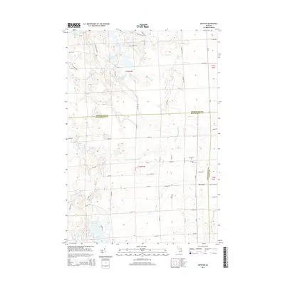
2014 Map of Royston
USGS Topo · Published 2014About this map
The North Br Thunder Bay River and Ocqueoc River define the watery landscape of this northern Michigan region, where three counties — Presque Isle, Montmorency, and Alpena — converge. This 2014 survey reveals a territory marked by numerous lakes and wetlands, including Lake Ferdelman, Marl Bed Lake, and Lake Ruth. The small settlement of Royston sits near the Alpena county line, serving as a focal point for the surrounding rural road network. Local history and genealogy are anchored by the Montmorency Cem and Saint Johns Cem located south of Hubert Rd. The drainage patterns of Truax Cr and Grass Cr illustrate the complex hydrography that has shaped land use and property boundaries across the Wellington Township area for generations.
Find a feature on this map
63 named features on this map. Tap any name to fly to it.
Don’t see what you’re looking for? This feature index may not catch every label — zoom into the map to look around manually.
Map Details
Editions of this 2014 Royston Map
This is the sole edition of this map. No revisions or reprints were ever made.
Other maps of this area

1954 · Alpena
USGS Topo · 1:250,000

1955 · Atlanta
USGS Topo · 1:62,500

1955 · Hillman
USGS Topo · 1:62,500

1955 · Cheboygan
USGS Topo · 1:250,000

1957 · Alpena
USGS Topo · 1:250,000

1957 · Onaway
USGS Topo · 1:62,500

1958 · Cheboygan
USGS Topo · 1:250,000

1958 · Alpena
USGS Topo · 1:250,000

1969 · Alpena
USGS Topo · 1:250,000

1971 · Hawks
USGS Topo · 1:24,000