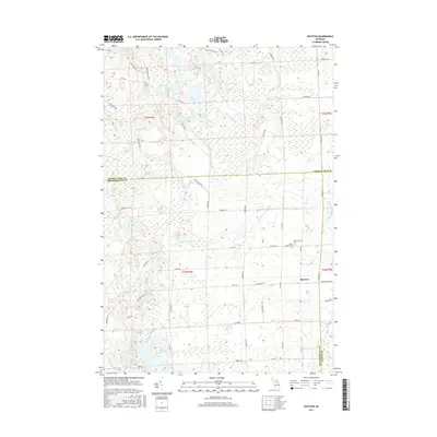
2017 Map of Royston
USGS Topo · Published 2017About this map
The Ocqueoc River and the N Br Thunder Bay River dominate this Northern Michigan landscape, where the boundaries of Presque Isle, Montmorency, and Alpena Counties meet. The settlement of Royston sits near the eastern edge of the survey, surrounded by a network of rural roads such as Royston Rd and Vogt Rd. The area is densely packed with wetlands and small water bodies, including Lake Emma, Lake Ferdelman, and the aptly named Marl Bed Lake. Genealogists and local historians will find the Montmorency Cem and Saint Johns Cem near the center of the map, providing specific points of interest for family research. The terrain is defined by low-lying basins and drainage systems like Truax Cr and Long Lake Pond, reflecting the glacial topography characteristic of the region.
Find a feature on this map
61 named features on this map. Tap any name to fly to it.
Don’t see what you’re looking for? This feature index may not catch every label — zoom into the map to look around manually.
Map Details
Editions of this 2017 Royston Map
This is the sole edition of this map. No revisions or reprints were ever made.
Other maps of this area

1954 · Alpena
USGS Topo · 1:250,000

1955 · Atlanta
USGS Topo · 1:62,500

1955 · Hillman
USGS Topo · 1:62,500

1955 · Cheboygan
USGS Topo · 1:250,000

1957 · Alpena
USGS Topo · 1:250,000

1957 · Onaway
USGS Topo · 1:62,500

1958 · Cheboygan
USGS Topo · 1:250,000

1958 · Alpena
USGS Topo · 1:250,000

1969 · Alpena
USGS Topo · 1:250,000

1971 · Hawks
USGS Topo · 1:24,000