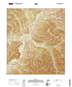
2019 Map of Ruby A-6 SE
USGS Topo · Published 2019About this map
Poorman stands as the primary point of human interest in this remote interior landscape, situated along the Ruby/Poorman Road (Extension). This region of Alaska, documented by the U.S. Geological Survey in 2019, is defined by an intricate network of drainages that follow the undulating contours of the Yukon-Koyukuk Census Area. Watercourses with names suggestive of early mining exploration, such as Tenderfoot Cr, Bonanza Cr, and Eldorado Cr, converge toward Poorman Cr in the northern half of the sheet. The southern section is dominated by the headwaters of Cache Cr and Gentian Cr. The orientation of these creeks and the solitary road connection highlight the area's isolation and its reliance on historic transport corridors established for resource extraction in the Alaskan wilderness.
Find a feature on this map
20 named features on this map. Tap any name to fly to it.
Don’t see what you’re looking for? This feature index may not catch every label — zoom into the map to look around manually.
Map Details
Editions of this 2019 Ruby A-6 SE Map
This is the sole edition of this map. No revisions or reprints were ever made.
Other maps of this area

1950 · Medfra
USGS Topo · 1:250,000

1951 · Ruby
USGS Topo · 1:250,000

1952 · Ruby A-5
USGS Topo · 1:63,360

1952 · Ruby A-6
USGS Topo · 1:63,360

1952 · Ruby
USGS Topo · 1:250,000

1954 · Medfra D-5
USGS Topo · 1:63,360

1954 · Medfra D-6
USGS Topo · 1:63,360

1959 · Medfra
USGS Topo · 1:250,000

1964 · Ruby
USGS Topo · 1:250,000
2019 · Medfra D-6 NE
USGS Topo · 1:25,000