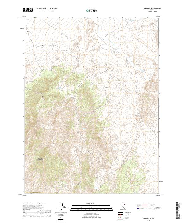
2021 Map of Ruby Lake NE
USGS Topo · Published 2021About this map
Maverick Springs Range dominates this corner of Elko County, where the high desert terrain is defined by its vital water sources. The map documents a rugged landscape punctuated by numerous isolated springs, including Gardner Spring, Willow Springs, and Cherry Spring, which provided essential sustenance for livestock and wildlife in this arid region of Nevada. The drainage pattern is marked by Ruby Wash and Cabin Run, carving through the topography near Red Hill. The presence of Maverick Springs at the southern end of the range highlights the historical importance of localized water points for range management and early travel through the Great Basin. This recent survey detail shows the enduring isolation of these high-altitude ranges, where the land remains largely defined by its natural hydrology and township boundaries.
Find a feature on this map
13 named features on this map. Tap any name to fly to it.
Don’t see what you’re looking for? This feature index may not catch every label — zoom into the map to look around manually.
Map Details
Editions of this 2021 Ruby Lake NE Map
This is the sole edition of this map. No revisions or reprints were ever made.
Other maps of this area

1955 · Elko
USGS Topo · 1:250,000

1958 · Elko
USGS Topo · 1:250,000

1962 · Elko
USGS Topo · 1:250,000

1965 · Elko
USGS Topo · 1:250,000

1968 · Franklin Lake SE
USGS Topo · 1:24,000

1968 · Franklin Lake SW
USGS Topo · 1:24,000
1968 · Ruby Lake SE
USGS Topo · 1:24,000
1968 · Ruby Lake NW
USGS Topo · 1:24,000

1968 · Ruby Lake NE
USGS Topo · 1:24,000
1969 · Station Butte
USGS Topo · 1:24,000