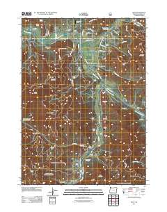
2011 Map of Ruch
USGS Topo · Published 2011About this map
The Applegate River and its valley dominate this Southern Oregon landscape, where the settlement of Ruch serves as a central hub for the surrounding gulches and ridges. The map details a network of rural routes such as Upper Applegate Rd and Eastside Rd that follow the river’s path toward the historic McKee Bridge area. To the east, the Little Applegate River flows through the community of Buncom, a notable landmark for local history researchers.
Find a feature on this map
66 named features on this map. Tap any name to fly to it.
Don’t see what you’re looking for? This feature index may not catch every label — zoom into the map to look around manually.
Map Details
Editions of this 2011 Ruch Map
This is the sole edition of this map. No revisions or reprints were ever made.
Other maps of this area

1891 · Ashland
USGS Topo · 1:250,000

1893 · Ashland
USGS Topo · 1:250,000

1897 · Ashland
USGS Topo · 1:250,000

1908 · Grants Pass
USGS Topo · 1:125,000

1938 · Medford
USGS Topo · 1:125,000

1954 · Medford
USGS Topo · 1:62,500

1954 · Gold Hill
USGS Topo · 1:62,500

1954 · Talent
USGS Topo · 1:62,500

1954 · Ruch
USGS Topo · 1:62,500

1955 · Medford
USGS Topo · 1:250,000