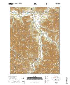
2020 Map of Ruch
USGS Topo · Published 2020About this map
The Applegate River and its numerous tributaries dominate this 2020 landscape in Jackson County, where the settlement of Ruch serves as a local hub. The map provides a detailed view of the complex water management systems essential to the region, including the historic China Ditch, Swayne Ditch, and the Hunter-Best Reservoirs. High elevation points such as Woodrat Mtn, Negro Ben Mtn, and Cinnabar Mtn define the surrounding terrain of the Rogue River National Forest.
Find a feature on this map
77 named features on this map. Tap any name to fly to it.
Don’t see what you’re looking for? This feature index may not catch every label — zoom into the map to look around manually.
Map Details
Editions of this 2020 Ruch Map
This is the sole edition of this map. No revisions or reprints were ever made.
Other maps of this area

1891 · Ashland
USGS Topo · 1:250,000

1893 · Ashland
USGS Topo · 1:250,000

1897 · Ashland
USGS Topo · 1:250,000

1908 · Grants Pass
USGS Topo · 1:125,000

1938 · Medford
USGS Topo · 1:125,000

1954 · Medford
USGS Topo · 1:62,500

1954 · Gold Hill
USGS Topo · 1:62,500

1954 · Talent
USGS Topo · 1:62,500

1954 · Ruch
USGS Topo · 1:62,500

1955 · Medford
USGS Topo · 1:250,000