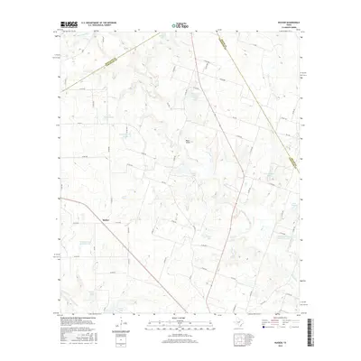
2016 Map of Rucker
USGS Topo · Published 2016About this map
Rucker and the surrounding ranchlands of Comanche County are defined by a complex network of tributaries feeding the central Leon River. In the mid-2010s, this landscape is a patchwork of small private impoundments and named reservoirs, such as Arvil Setzler Lake, Hardin Number 2 Lake, and Glover Lake. These water features, alongside seasonal drainages like Ellison Spring Br and Hog Cr, reflect the vital importance of water management for livestock and agriculture in this part of Texas.
Find a feature on this map
64 named features on this map. Tap any name to fly to it.
Don’t see what you’re looking for? This feature index may not catch every label — zoom into the map to look around manually.
Map Details
Editions of this 2016 Rucker Map
This is the sole edition of this map. No revisions or reprints were ever made.
Other maps of this area

1890 · Stephenville
USGS Topo · 1:125,000

1894 · Eastland
USGS Topo · 1:125,000

1920 · Stephenville
USGS Topo · 1:125,000

1954 · Abilene
USGS Topo · 1:250,000

1958 · Abilene
USGS Topo · 1:250,000

1965 · Huckabay SW
USGS Topo · 1:24,000

1965 · Lingleville
USGS Topo · 1:24,000
1965 · Comyn
USGS Topo · 1:24,000

1966 · Kokomo
USGS Topo · 1:24,000
1966 · Desdemona
USGS Topo · 1:24,000