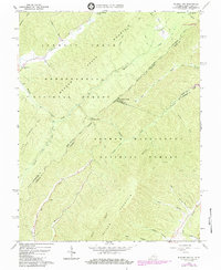
1966 Map of Rucker Gap
USGS Topo · Published 1984About this map
Anthony Creek and the surrounding drainage basins of the Allegheny Mountain range dominate this landscape along the border of Virginia and West Virginia during the mid-1960s. The map illustrates a densely forested interior where the Monongahela National Forest and George Washington National Forest converge. Settlement is sparse, localized primarily around the Neola Road corridor where Watts Chapel and a small Cem are located.
Find a feature on this map
40 named features on this map. Tap any name to fly to it.
Don’t see what you’re looking for? This feature index may not catch every label — zoom into the map to look around manually.
Map Details
Editions of this 1966 Rucker Gap Map
2 editions found
Other maps of this area

1887 · Lewisburg
USGS Topo · 1:125,000

1891 · Lewisburg
USGS Topo · 1:125,000

1891 · Huntersville
USGS Topo · 1:125,000

1894 · Huntersville
USGS Topo · 1:125,000

1894 · Natural Bridge
USGS Topo · 1:125,000

1901 · Monterey
USGS Topo · 1:125,000

1921 · Callaghan
USGS Topo · 1:48,000

1923 · Marlinton
USGS Topo · 1:48,000

1923 · Warm Springs
USGS Topo · 1:48,000

1923 · Callaghan
USGS Topo · 1:62,500