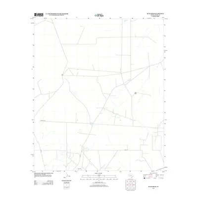
2013 Map of Rudd Draw
USGS Topo · Published 2013About this map
Slash Ranch anchors this sparse landscape in Loving County, Texas, providing a clear look at the ranching infrastructure and drainage patterns of the Trans-Pecos region in the early twenty-first century. The terrain is defined by a network of seasonal water sources and ephemeral washes, most notably Rudd Draw, which snakes through the eastern half of the quadrangle. Man-made improvements for livestock and navigation are evident in features such as Gillespie Tank, Gilliland Tank, and the curiously named Beacon Light Lake. The transportation network is primarily composed of county routes, including Co Rd 22 and Co Hwy 1.2, which navigate the wide-open ranch lands. This U.S. Geological Survey topographic map serves as a precise record of land use and water management in one of the most sparsely populated areas of Texas.
Find a feature on this map
10 named features on this map. Tap any name to fly to it.
Don’t see what you’re looking for? This feature index may not catch every label — zoom into the map to look around manually.
Map Details
Editions of this 2013 Rudd Draw Map
This is the sole edition of this map. No revisions or reprints were ever made.
Other maps of this area

1954 · Pecos
USGS Topo · 1:250,000

1957 · Pecos
USGS Topo · 1:250,000

1961 · Mentone
USGS Topo · 1:24,000

1961 · Anderson Ranch
USGS Topo · 1:24,000

1961 · Lindley Ranch
USGS Topo · 1:24,000

1967 · Soda Lake NW
USGS Topo · 1:24,000

1969 · Kyle Ranch
USGS Topo · 1:24,000

1969 · Cheyenne Draw SW
USGS Topo · 1:24,000

1969 · Rudd Draw NE
USGS Topo · 1:24,000
1969 · Rudd Draw
USGS Topo · 1:24,000