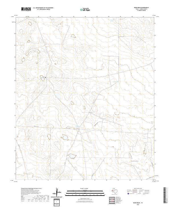
2022 Map of Rudd Draw
USGS Topo · Published 2022About this map
Rudd Draw carves a subtle path through this sparsely settled portion of Loving County, where the landscape is defined more by ranching infrastructure and local roads than by dense development. The presence of the Slash Ranch Cem serves as a lone marker of family legacy and early settlement in this arid Texas expanse. Water management is central to life here, evidenced by several scattered catchments like Gillespie Tank, Gilliland Tank, and the uniquely named Beacon Light Lake. A network of utilitarian routes, including Lumber Co Rd and Reeves Co 440, provides the necessary framework for navigating the wide distances between these landmarks. This modern survey illustrates the enduring nature of rural West Texas, where historic ranch names and local identifiers like Cattle Guard 21 Rd remain the primary points of orientation.
Find a feature on this map
11 named features on this map. Tap any name to fly to it.
Don’t see what you’re looking for? This feature index may not catch every label — zoom into the map to look around manually.
Map Details
Editions of this 2022 Rudd Draw Map
This is the sole edition of this map. No revisions or reprints were ever made.
Other maps of this area

1954 · Pecos
USGS Topo · 1:250,000

1957 · Pecos
USGS Topo · 1:250,000

1961 · Mentone
USGS Topo · 1:24,000

1961 · Anderson Ranch
USGS Topo · 1:24,000

1961 · Lindley Ranch
USGS Topo · 1:24,000

1967 · Soda Lake NW
USGS Topo · 1:24,000

1969 · Kyle Ranch
USGS Topo · 1:24,000

1969 · Cheyenne Draw SW
USGS Topo · 1:24,000

1969 · Rudd Draw NE
USGS Topo · 1:24,000
1969 · Rudd Draw
USGS Topo · 1:24,000