
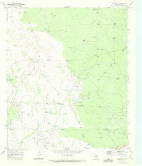
1969 Map of Rudd Draw NE
USGS Topo · Published 1972About this map
The New Mexico and Texas border cuts across the northern reaches of this landscape, where the high plains transition into the industrial energy frontiers of the late 1960s. This survey of the Lea County and Loving County line highlights an arid environment dominated by petroleum extraction and water management. The western portion of the map is heavily marked by the infrastructure of the El Mar Oil Field and the Grice Oil Field, characterized by numerous Drill Holes and a prominent Pipeline network.
Find a feature on this map
18 named features on this map. Tap any name to fly to it.
Don’t see what you’re looking for? This feature index may not catch every label — zoom into the map to look around manually.
Map Details
Editions of this 1969 Rudd Draw NE Map
This is the sole edition of this map. No revisions or reprints were ever made.
Other maps of this area

1954 · Hobbs
USGS Topo · 1:250,000

1954 · Pecos
USGS Topo · 1:250,000

1957 · Pecos
USGS Topo · 1:250,000

1958 · Hobbs
USGS Topo · 1:250,000

1961 · Lindley Ranch
USGS Topo · 1:24,000

1969 · Kyle Ranch
USGS Topo · 1:24,000

1969 · Cheyenne Draw SW
USGS Topo · 1:24,000
1969 · Rudd Draw
USGS Topo · 1:24,000

1970 · Brunson Ranch
USGS Topo · 1:24,000

1973 · Paduca Breaks East
USGS Topo · 1:24,000