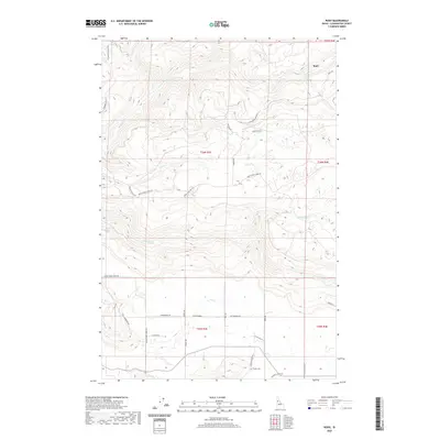
2020 Map of Rudo
USGS Topo · Published 2020About this map
Orofino Cr and Texas Cr define the intricate drainage patterns of this Clearwater County landscape, where the settlement of Rudo sits near the northern boundary. The terrain is a network of named watercourses including Cook Cr, Cooper Cr, and Jim Ford Cr, each carving through the high country. Historically significant routes like the Old Deer Creek Grade and Upper Fords Creek Rd suggest a legacy of timber or ranching access through these hills. Genealogists can find the Fraser Cem located in the southern section along Clark Valley Ct, while the presence of Cooks Cemetery Rd further north points to additional local burial sites. This modern survey provides a detailed look at the rural road network, from Cottonwood Rd to the curiously named Poverty Gulch Rd, reflecting the complex topography of the Idaho panhandle.
Find a feature on this map
33 named features on this map. Tap any name to fly to it.
Don’t see what you’re looking for? This feature index may not catch every label — zoom into the map to look around manually.
Map Details
Editions of this 2020 Rudo Map
This is the sole edition of this map. No revisions or reprints were ever made.
Other maps of this area

1923 · Washington Creek
USGS Topo · 1:125,000

1924 · Kamiah
USGS Topo · 1:125,000

1924 · Weippe
USGS Topo · 1:125,000

1938 · Headquarters
USGS Topo · 1:48,000

1944 · Headquarters
USGS Topo · 1:62,500

1955 · Pullman
USGS Topo · 1:250,000

1956 · Hamilton
USGS Topo · 1:250,000

1958 · Pullman
USGS Topo · 1:250,000

1959 · Hamilton
USGS Topo · 1:250,000

1960 · Hamilton
USGS Topo · 1:250,000