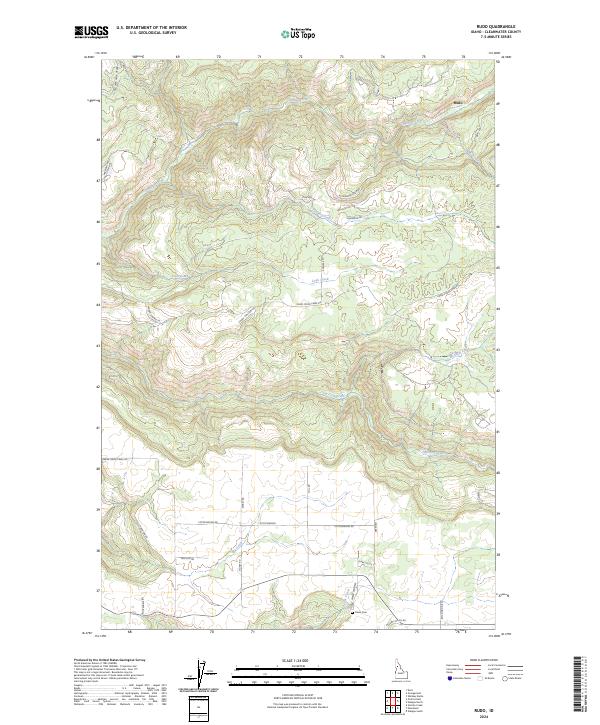
2024 Map of Rudo
USGS Topo · Published 2024About this map
Orofino Creek and its many tributaries, including Rudo Creek and Jim Ford Creek, carve through the varied Clearwater County terrain of this 2024 survey. The map centers on a landscape where rural development and historical land divisions intersect, notably near the settlement of Rudo and the agricultural area of Cottonwood. Local history is anchored by Fraser Cemetery (also marked as Fraser Cem) and the residential presence indicated by Clark Valley Ct. A network of logging and local roads, such as Old Deer Creek Grade, Upper Fords Creek Rd, and Poverty Gulch Rd, reveals the enduring importance of timber and land access in this Idaho interior. The survey clearly delineates the complex township and range boundaries that have organized this region for generations, from t37n r4e down to t35n r4e.
Find a feature on this map
38 named features on this map. Tap any name to fly to it.
Don’t see what you’re looking for? This feature index may not catch every label — zoom into the map to look around manually.
Map Details
Editions of this 2024 Rudo Map
This is the sole edition of this map. No revisions or reprints were ever made.
Other maps of this area

1923 · Washington Creek
USGS Topo · 1:125,000

1924 · Kamiah
USGS Topo · 1:125,000

1924 · Weippe
USGS Topo · 1:125,000

1938 · Headquarters
USGS Topo · 1:48,000

1944 · Headquarters
USGS Topo · 1:62,500

1955 · Pullman
USGS Topo · 1:250,000

1956 · Hamilton
USGS Topo · 1:250,000

1958 · Pullman
USGS Topo · 1:250,000

1959 · Hamilton
USGS Topo · 1:250,000

1960 · Hamilton
USGS Topo · 1:250,000