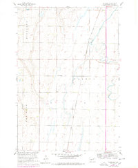
1960 Map of Rudolph
USGS Topo · Published 1978About this map
Rudolph serves as a central point of reference along the Chicago and North Western railroad line in this section of Brown County. The landscape is defined by the winding course of Moccasin Creek, which cuts through the townships of Highland, Warner, and New Hope. This document, updated by the U.S. Bureau of Reclamation, provides a clear look at the rural infrastructure of the mid-20th century, where small local institutions served the agricultural population. Educational sites like St John Sch and Sunshine Sch are clearly marked alongside the Warner Cem, offering vital location data for genealogists and local historians tracking family footprints across these Dakota sections. The transition from early 1960s field data to late 1970s revisions highlights the enduring boundaries of the Missouri River Basin development era.
Find a feature on this map
12 named features on this map. Tap any name to fly to it.
Don’t see what you’re looking for? This feature index may not catch every label — zoom into the map to look around manually.
Map Details
Editions of this 1960 Rudolph Map
2 editions found
Other maps of this area

1895 · Aberdeen
USGS Topo · 1:125,000

1899 · Northville
USGS Topo · 1:125,000

1953 · Warner
USGS Topo · 1:24,000

1954 · Mellette
USGS Topo · 1:24,000

1954 · Aberdeen
USGS Topo · 1:250,000

1956 · Aberdeen
USGS Topo · 1:250,000
1960 · Aberdeen East
USGS Topo · 1:24,000

1960 · Aberdeen West
USGS Topo · 1:24,000

1960 · Rudolph
USGS Topo · 1:24,000
1960 · Northville
USGS Topo · 1:24,000