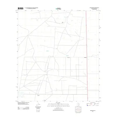
2013 Map of Rudolph
USGS Topo · Published 2013About this map
The coastal prairie of Kenedy County is defined here by the sparse settlement and ranching infrastructure characteristic of the South Texas brush country. Rudolph stands as a focal point along the primary transportation corridor, while further south lies the Garcia Ranch, illustrating the large-scale landholdings that have shaped the region for generations. The landscape is dotted with low-lying terrain features such as Loma Prieta and the ephemeral basins of La Badia de Pitoso and La Badia del Divisadero. These seasonal wetlands and depressions, alongside the Los Cuates Windmill, highlight the critical importance of water management in an environment where natural surface water is rare and land use is dictated by the availability of groundwater. The proximity of Divisadero to these features suggests a historical reliance on these specific geographic markers for navigation and survival in the flat, expansive terrain.
Find a feature on this map
7 named features on this map. Tap any name to fly to it.
Don’t see what you’re looking for? This feature index may not catch every label — zoom into the map to look around manually.
Map Details
Editions of this 2013 Rudolph Map
This is the sole edition of this map. No revisions or reprints were ever made.
Other maps of this area

1921 · Tarida Ranch
USGS Topo · 1:62,500

1922 · La Sal Vieja
USGS Topo · 1:62,500

1923 · Armstrong
USGS Topo · 1:62,500

1923 · Saltillo Ranch
USGS Topo · 1:62,500

1953 · Brownsville
USGS Topo · 1:250,000

1956 · Julian
USGS Topo · 1:24,000

1956 · Saltillo Well
USGS Topo · 1:24,000

1956 · Rudolph
USGS Topo · 1:24,000

1956 · Andrea Ranch
USGS Topo · 1:24,000

1956 · Rosita Lake
USGS Topo · 1:24,000