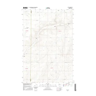
2017 Map of Ruff
USGS Topo · Published 2017About this map
Ruff and Moody anchor this high-plateau landscape along the Grant and Adams County line. The terrain is defined by dry drainage features characteristic of the region, specifically the significant depressions of Sand Coulee, Rocky Branch Coulee, and Rocky Coulee. This 2017 survey reveals a strictly organized grid of agricultural access roads, including W Griffith Rd, W Tokio Rd, and W Rehn Rd, which partition the land into large-scale farming blocks. The topographic data captures the subtle elevation changes of the coulees as they cut through the agricultural plains, providing a clear view of the land-use patterns in this part of Washington's interior before modern developments might further alter the historic survey lines of the Public Land Survey System.
Find a feature on this map
26 named features on this map. Tap any name to fly to it.
Don’t see what you’re looking for? This feature index may not catch every label — zoom into the map to look around manually.
Map Details
Editions of this 2017 Ruff Map
This is the sole edition of this map. No revisions or reprints were ever made.
Other maps of this area

1923 · Wheeler
USGS Topo · 1:62,500

1925 · Wheeler
USGS Topo · 1:62,500

1925 · Schrag
USGS Topo · 1:62,500

1953 · Ritzville
USGS Topo · 1:250,000
1956 · Bassett Junction
USGS Topo · 1:24,000

1956 · Wheeler NE
USGS Topo · 1:24,000

1956 · Wilson Creek SE
USGS Topo · 1:24,000

1956 · Wilson Creek
USGS Topo · 1:62,500
1956 · Wheeler
USGS Topo · 1:62,500

1959 · Ritzville
USGS Topo · 1:250,000