
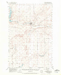
1956 Map of Wilson Creek
USGS Topo · Published 1958About this map
Wilson Creek sits at the confluence of several vital waterways in this mid-century survey of the Grant County landscape. The Great Northern railway corridor dictates the local geography, running parallel to Crab Creek and supporting the area's agricultural and transit economy. The presence of the Landing Field and a small Cem near the town center provides a clear view of the settlement's infrastructure during the late 1950s.
Find a feature on this map
29 named features on this map. Tap any name to fly to it.
Don’t see what you’re looking for? This feature index may not catch every label — zoom into the map to look around manually.
Map Details
Editions of this 1956 Wilson Creek Map
2 editions found
Other maps of this area

1912 · Moses Lake
USGS Topo · 1:62,500

1923 · Wheeler
USGS Topo · 1:62,500

1925 · Wheeler
USGS Topo · 1:62,500

1925 · Schrag
USGS Topo · 1:62,500

1953 · Ritzville
USGS Topo · 1:250,000

1956 · Wheeler
USGS Topo · 1:24,000

1956 · Stratford
USGS Topo · 1:24,000

1956 · Moses Lake North
USGS Topo · 1:24,000

1956 · Gloyd
USGS Topo · 1:24,000

1956 · Wilson Creek SW
USGS Topo · 1:24,000