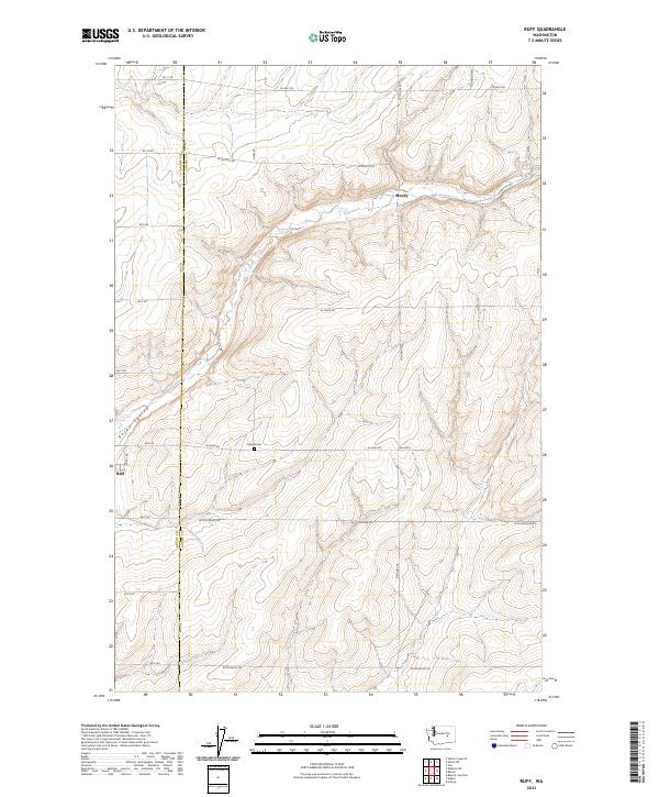
2023 Map of Ruff
USGS Topo · Published 2023About this map
Rocky Coulee carves through this portion of the Columbia Basin, where the border between Grant and Adams counties bisects the rural landscape. This modern survey illustrates the organized township and range system that continues to define the agricultural layout of the region. Small settlements like Moody and Ruff serve as geographic anchors for the surrounding farmstead network, which is connected by a strict grid of section-line roads such as W Schoessler Rd and W Arlt Rd. For those researching family history in this corner of Washington, the Kappel Cem remains a significant landmark along W Rehn Rd, providing a specific point of reference for early inhabitants of the area. The map's contour lines emphasize the subtle but distinct drainage patterns and coulee formations that have influenced settlement and transportation routes across the high desert.
Find a feature on this map
25 named features on this map. Tap any name to fly to it.
Don’t see what you’re looking for? This feature index may not catch every label — zoom into the map to look around manually.
Map Details
Editions of this 2023 Ruff Map
This is the sole edition of this map. No revisions or reprints were ever made.
Other maps of this area

1923 · Wheeler
USGS Topo · 1:62,500

1925 · Wheeler
USGS Topo · 1:62,500

1925 · Schrag
USGS Topo · 1:62,500

1953 · Ritzville
USGS Topo · 1:250,000
1956 · Bassett Junction
USGS Topo · 1:24,000

1956 · Wheeler NE
USGS Topo · 1:24,000

1956 · Wilson Creek SE
USGS Topo · 1:24,000

1956 · Wilson Creek
USGS Topo · 1:62,500
1956 · Wheeler
USGS Topo · 1:62,500

1959 · Ritzville
USGS Topo · 1:250,000