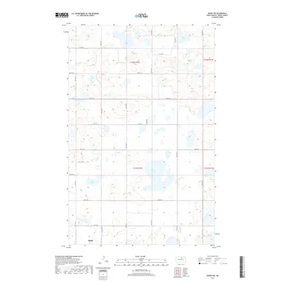
2017 Map of Rugby NW
USGS Topo · Published 2017About this map
Rugby anchors the southwestern corner of this North Dakota landscape, a region defined by its distinct glacial prairie pothole topography. The terrain is characterized by a high density of small lakes and seasonal wetlands, including named bodies of water like Goose Lake, Soap Lake, Herd Lake, and Spring Lake. These basins are scattered across the township lines of t158n r72w and t157n r72w, where the local relief is shaped by low, undulating hills and depressions. The settlement pattern follows a rigid section-line road grid typical of the High Plains, illustrating the systematic land division of the region. This 2017 survey provides a detailed look at the hydrology of Pierce County, showing how the natural drainage and water storage features interact with agricultural land use and the northern edge of the regional hub of Rugby.
Find a feature on this map
9 named features on this map. Tap any name to fly to it.
Don’t see what you’re looking for? This feature index may not catch every label — zoom into the map to look around manually.
Map Details
Editions of this 2017 Rugby NW Map
This is the sole edition of this map. No revisions or reprints were ever made.
Other maps of this area

1953 · Devils Lake
USGS Topo · 1:250,000

1954 · Tunbridge
USGS Topo · 1:24,000

1954 · Overly SE
USGS Topo · 1:24,000

1954 · Rugby NW
USGS Topo · 1:24,000

1954 · Leverich
USGS Topo · 1:24,000

1954 · Minot
USGS Topo · 1:250,000

1955 · Rugby
USGS Topo · 1:24,000

1955 · Rolette SW
USGS Topo · 1:24,000

1956 · Devils Lake
USGS Topo · 1:250,000

1958 · Minot
USGS Topo · 1:250,000