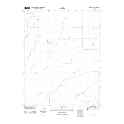
2010 Map of Ruin Canyon
USGS Topo · Published 2010About this map
Ruin Canyon and its network of deep drainage systems define this landscape in Montezuma County, where modern energy extraction meets older mining claims. The north is marked by the Papoose Canyon Oil Field, while the central plateau around Squaw Point shows a cluster of named workings including the Yellow Lizard Mine, Roberta Jean Mine, and Le-Ru Mines. These features suggest a history of varied mineral interests and geological exploration in a region better known for its archaeological significance.
Find a feature on this map
26 named features on this map. Tap any name to fly to it.
Don’t see what you’re looking for? This feature index may not catch every label — zoom into the map to look around manually.
Map Details
Editions of this 2010 Ruin Canyon Map
This is the sole edition of this map. No revisions or reprints were ever made.
Other maps of this area

1886 · Abajo
USGS Topo · 1:250,000

1892 · Abajo
USGS Topo · 1:250,000

1893 · Abajo
USGS Topo · 1:250,000

1956 · Cortez
USGS Topo · 1:250,000

1957 · Moqui NW
USGS Topo · 1:24,000

1957 · Cedar 3 NW
USGS Topo · 1:24,000

1957 · Aneth 1 NE
USGS Topo · 1:24,000

1957 · Cedar 3 SW
USGS Topo · 1:24,000

1957 · Monument Canyon
USGS Topo · 1:62,500
1958 · Verdure 4 NE
USGS Topo · 1:24,000