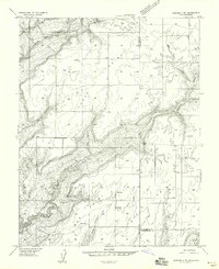
1958 Map of Verdure 4 NE
USGS Topo · Published 1958About this map
Cedar Point and Bug Point dominate the high ground of this high-desert landscape on the border of Utah and Colorado in the late 1950s. The terrain is deeply incised by a network of drainage systems, including Monument Canyon and Coal Bed Canyon, which channel water through the arid plateau. This preliminary survey, based on 1955 aerial photography, reveals a remote ranching or agricultural environment where human presence is marked by isolated reservoirs and a solitary Cemetery near the center of the sheet. The network of unimproved roads and a specific Jeep Trail in the eastern section suggests a reliance on rugged transport to navigate between the high mesas and the winding corridors of Oak Creek Canyon and Squaw Canyon. The map also captures a rare tri-county junction where San Juan, Dolores, and Montezuma counties meet.
Find a feature on this map
15 named features on this map. Tap any name to fly to it.
Don’t see what you’re looking for? This feature index may not catch every label — zoom into the map to look around manually.
Map Details
Editions of this 1958 Verdure 4 NE Map
This is the sole edition of this map. No revisions or reprints were ever made.
Other maps of this area

1886 · Abajo
USGS Topo · 1:250,000

1892 · Abajo
USGS Topo · 1:250,000

1893 · Abajo
USGS Topo · 1:250,000

1955 · Verdure 4 NW
USGS Topo · 1:24,000

1955 · Verdure 1 SW
USGS Topo · 1:24,000

1955 · Verdure 4 SW
USGS Topo · 1:24,000

1956 · Cortez
USGS Topo · 1:250,000

1957 · Cedar 3 NW
USGS Topo · 1:24,000

1957 · Cedar 3 SW
USGS Topo · 1:24,000

1957 · Monument Canyon
USGS Topo · 1:62,500