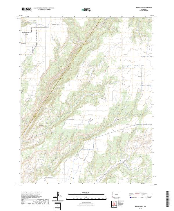
2023 Map of Ruin Canyon
USGS Topo · Published 2023About this map
The border between Dolores and Montezuma counties cuts through this modern survey of the high desert plateau. The landscape is defined by a series of deep drainage systems, including the prominent Ruin Canyon and the neighboring Hovenweep Canyon, reflecting the ancient geological and cultural importance of this arid region. Near the northeastern corner of the map, Sylvan Cem provides a point of interest for genealogists tracking early settlers of the Four Corners area.
Find a feature on this map
31 named features on this map. Tap any name to fly to it.
Don’t see what you’re looking for? This feature index may not catch every label — zoom into the map to look around manually.
Map Details
Editions of this 2023 Ruin Canyon Map
This is the sole edition of this map. No revisions or reprints were ever made.
Other maps of this area

1886 · Abajo
USGS Topo · 1:250,000

1892 · Abajo
USGS Topo · 1:250,000

1893 · Abajo
USGS Topo · 1:250,000

1956 · Cortez
USGS Topo · 1:250,000

1957 · Moqui NW
USGS Topo · 1:24,000

1957 · Cedar 3 NW
USGS Topo · 1:24,000

1957 · Aneth 1 NE
USGS Topo · 1:24,000

1957 · Cedar 3 SW
USGS Topo · 1:24,000

1957 · Monument Canyon
USGS Topo · 1:62,500
1958 · Verdure 4 NE
USGS Topo · 1:24,000