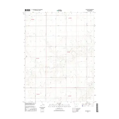
2015 Map of Ruleton NE
USGS Topo · Published 2015About this map
New Liberty Cem sits as a lonely marker of community history in this expansive stretch of the High Plains, located just west of Middle Beaver Cr. The landscape is defined by the subtle drainage patterns of the Middle Beaver Cr and S Beaver Cr, which cut through the agricultural sections of Sherman County. This 2015 update to the geographic record highlights the grid of county roads, such as Co RD 13 and Co RD 71, that partition the land into its constituent townships including t7s r41w and t7s r40w. The map illustrates the sparse, high-altitude prairie environment where watercourses provide the primary relief in an otherwise strictly surveyed agricultural grid.
Find a feature on this map
25 named features on this map. Tap any name to fly to it.
Don’t see what you’re looking for? This feature index may not catch every label — zoom into the map to look around manually.
Map Details
Editions of this 2015 Ruleton NE Map
This is the sole edition of this map. No revisions or reprints were ever made.
Other maps of this area

1951 · Bird City South
USGS Topo · 1:62,500

1952 · St Francis 3
USGS Topo · 1:62,500

1954 · Goodland
USGS Topo · 1:250,000

1956 · Goodland
USGS Topo · 1:250,000

1957 · Goodland
USGS Topo · 1:250,000

1966 · Goodland NW
USGS Topo · 1:24,000

1966 · Goodland
USGS Topo · 1:24,000

1966 · Ruleton NW
USGS Topo · 1:24,000

1966 · Ruleton NE
USGS Topo · 1:24,000

1966 · Ruleton
USGS Topo · 1:24,000