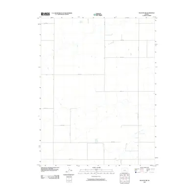
2009 Map of Ruleton NW
USGS Topo · Published 2009About this map
Middle Beaver Creek winds through the southeastern reaches of this Sherman County landscape, providing a primary drainage point in an otherwise uniform agricultural grid. This portion of the Kansas High Plains is defined by its meticulous section-line road system, where thoroughfares such as N Ruleton Ave and Co Rd 72 intersect to support the local farming economy. Small, scattered water impoundments are visible across the prairie, reflecting the modern management of surface water in a semi-arid region. The absence of concentrated settlements within this quadrangle emphasizes the rural character of the area, where isolated structures and farmsteads are linked by a network of county roads including Co Rd 8 and Co Rd 70.
Find a feature on this map
16 named features on this map. Tap any name to fly to it.
Don’t see what you’re looking for? This feature index may not catch every label — zoom into the map to look around manually.
Map Details
Editions of this 2009 Ruleton NW Map
This is the sole edition of this map. No revisions or reprints were ever made.
Other maps of this area

1950 · Bonny Reservoir
USGS Topo · 1:62,500

1952 · St Francis 3
USGS Topo · 1:62,500

1954 · Limon
USGS Topo · 1:250,000

1954 · Goodland
USGS Topo · 1:250,000

1956 · Goodland
USGS Topo · 1:250,000

1957 · Limon
USGS Topo · 1:250,000

1957 · Goodland
USGS Topo · 1:250,000

1958 · Limon
USGS Topo · 1:250,000

1966 · Ruleton NW
USGS Topo · 1:24,000

1966 · Ruleton NE
USGS Topo · 1:24,000