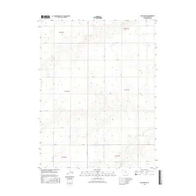
2015 Map of Ruleton NW
USGS Topo · Published 2015About this map
The High Plains of Sherman County are defined by a strict section-line grid in this 2015 study, where the agricultural landscape is carved by the intermittent path of Middle Beaver Cr. The map covers the rural northwestern corner of the county, documented across six townships including t7s r41w and t7s r42w. The terrain is predominantly open, with subtle elevation changes indicated by the fine contouring of the prairie. A dense network of county roads, such as Co RD 75 on the northern boundary and Co RD 67 to the south, provides the primary infrastructure for this remote ranching and farming region. The layout reflects a century of land management under the Public Land Survey System, with roads like Co RD 5 and Co RD 10 marking the vertical boundaries of this expansive Kansas landscape.
Find a feature on this map
22 named features on this map. Tap any name to fly to it.
Don’t see what you’re looking for? This feature index may not catch every label — zoom into the map to look around manually.
Map Details
Editions of this 2015 Ruleton NW Map
This is the sole edition of this map. No revisions or reprints were ever made.
Other maps of this area

1950 · Bonny Reservoir
USGS Topo · 1:62,500

1952 · St Francis 3
USGS Topo · 1:62,500

1954 · Limon
USGS Topo · 1:250,000

1954 · Goodland
USGS Topo · 1:250,000

1956 · Goodland
USGS Topo · 1:250,000

1957 · Limon
USGS Topo · 1:250,000

1957 · Goodland
USGS Topo · 1:250,000

1958 · Limon
USGS Topo · 1:250,000

1966 · Ruleton NW
USGS Topo · 1:24,000

1966 · Ruleton NE
USGS Topo · 1:24,000