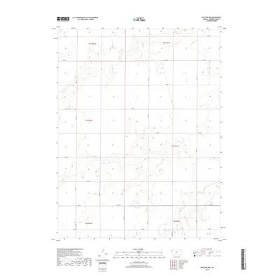
2018 Map of Ruleton NW
USGS Topo · Published 2018About this map
The High Plains of Sherman County are defined by a vast grid of section lines and drainage patterns in this 2018 survey. The southeastern corner of the quadrangle is marked by the meandering path of Middle Beaver Cr, which cuts through the otherwise uniform agricultural landscape. This portion of the county, organized under townships such as t7s r41w and t8s r42w, maintains a strict rectilinear geometry governed by a network of local thoroughfares. These routes, including Co Rd 75 at the northern boundary and Co Rd 67 at the south, serve as the primary infrastructure for the dispersed farmsteads of the region. The map illustrates the intersection of human-imposed township boundaries with the subtle natural topography of western Kansas, providing a detailed view of the rural section-line road system that has dictated land use for generations.
Find a feature on this map
22 named features on this map. Tap any name to fly to it.
Don’t see what you’re looking for? This feature index may not catch every label — zoom into the map to look around manually.
Map Details
Editions of this 2018 Ruleton NW Map
This is the sole edition of this map. No revisions or reprints were ever made.
Other maps of this area

1950 · Bonny Reservoir
USGS Topo · 1:62,500

1952 · St Francis 3
USGS Topo · 1:62,500

1954 · Limon
USGS Topo · 1:250,000

1954 · Goodland
USGS Topo · 1:250,000

1956 · Goodland
USGS Topo · 1:250,000

1957 · Limon
USGS Topo · 1:250,000

1957 · Goodland
USGS Topo · 1:250,000

1958 · Limon
USGS Topo · 1:250,000

1966 · Ruleton NW
USGS Topo · 1:24,000

1966 · Ruleton NE
USGS Topo · 1:24,000