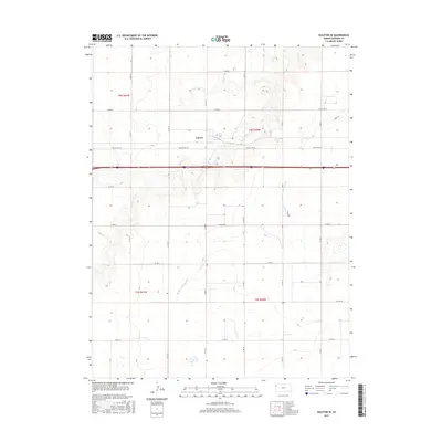
2015 Map of Ruleton SE
USGS Topo · Published 2015About this map
Caruso stands as the primary settlement in this High Plains landscape, situated at the junction of modern infrastructure and early transit routes. The township is characterized by a sprawling grid of county roads, such as Co Rd 66 and Co Rd 14, which overlay the section lines of the Public Land Survey System. The map records a moment where modern Interstate 70 runs parallel to the historic path of Old US Hwy 24, illustrating the evolution of transcontinental travel across Sherman County. Hydrological features like S Beaver Cr and the Middle Fork Sappa Cr cut through the geometric regularity of the farmland, providing natural drainage for the surrounding agricultural tracts. This 2015 survey provides a clear view of the rural settlement patterns and the enduring importance of the road network in sustaining this interior Kansas community.
Find a feature on this map
21 named features on this map. Tap any name to fly to it.
Don’t see what you’re looking for? This feature index may not catch every label — zoom into the map to look around manually.
Map Details
Editions of this 2015 Ruleton SE Map
This is the sole edition of this map. No revisions or reprints were ever made.
Other maps of this area

1954 · Goodland
USGS Topo · 1:250,000

1956 · Goodland
USGS Topo · 1:250,000

1957 · Goodland
USGS Topo · 1:250,000

1959 · Harris Draw
USGS Topo · 1:62,500

1959 · Horsethief Draw
USGS Topo · 1:62,500

1966 · Goodland NW
USGS Topo · 1:24,000

1966 · Goodland
USGS Topo · 1:24,000

1966 · Ruleton NW
USGS Topo · 1:24,000

1966 · Ruleton NE
USGS Topo · 1:24,000

1966 · Ruleton
USGS Topo · 1:24,000