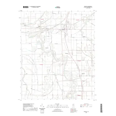
2020 Map of Ruleville
USGS Topo · Published 2020About this map
The Big Sunflower River and Quiver River dominate this modern topographical record of the Mississippi Delta, winding through the alluvial plains of Sunflower County. The central hub of Ruleville is detailed alongside smaller agricultural settlements like Doddsville, Cottondale, and Linn. The landscape is a complex network of bayous, including Blackhaw Bayou, Burrell Bayou, and Daugherty Bayou, which historically dictated the placement of roads and early homesteads. Genealogists will find significant value in the distribution of family and community burial grounds, such as Lehrton Cem, Hillhouse Cem, Marlow Cem, and Mount Zion Cem. Transportation history is visible at crossings like the Old Lehrton Bridge and Hannahs Bridge, while the region's plantation history is reflected in the surrounding fields and proximity to the hamlet of Dockery.
Find a feature on this map
94 named features on this map. Tap any name to fly to it.
Don’t see what you’re looking for? This feature index may not catch every label — zoom into the map to look around manually.
Map Details
Editions of this 2020 Ruleville Map
This is the sole edition of this map. No revisions or reprints were ever made.
Other maps of this area

1931 · Schlater
USGS Topo · 1:48,000

1931 · Sumner
USGS Topo · 1:48,000

1931 · Drew
USGS Topo · 1:48,000

1934 · Cleveland
USGS Topo · 1:62,500

1934 · Schlater
USGS Topo · 1:62,500

1935 · Sumner
USGS Topo · 1:62,500

1935 · Mound Bayou
USGS Topo · 1:62,500

1939 · Schlater
USGS Topo · 1:62,500

1939 · Sumner
USGS Topo · 1:62,500

1940 · Cleveland
USGS Topo · 1:62,500