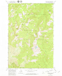
1966 Map of Running Lake
USGS Topo · Published 1979About this map
Running Lake and the high peaks of the Nez Perce National Forest dominate this mid-century survey of Idaho's wilderness. Situated within the Selway-Bitterroot Wilderness, the area is defined by a network of primitive pack trails and isolated water bodies such as Bilk Lake, Fawn Lake, and Square Rock Lake. The lack of established land lines reflects the untamed nature of this interior landscape, where names like Grave Meadow and Windy Saddle suggest the early experiences of those who traversed these ridges. Significant landmarks like Grave Meadow Peak, Indian Peak, and Elk Mountain provide prominent navigational points for backcountry travelers. This map captures a landscape almost entirely devoid of modern infrastructure, with drainage systems like Marten Creek and Running Creek carving deep into the terrain. Local history and exploration are noted through names such as Matteson and Mink near the boundary lines.
Find a feature on this map
39 named features on this map. Tap any name to fly to it.
Don’t see what you’re looking for? This feature index may not catch every label — zoom into the map to look around manually.
Map Details
Editions of this 1966 Running Lake Map
3 editions found
Other maps of this area

1911 · Lolo
USGS Topo · 1:250,000

1913 · Lolo
USGS Topo · 1:250,000

1956 · Elk City
USGS Topo · 1:250,000

1956 · Hamilton
USGS Topo · 1:250,000

1959 · Hamilton
USGS Topo · 1:250,000

1960 · Elk City
USGS Topo · 1:250,000

1960 · Hamilton
USGS Topo · 1:250,000

1964 · Hamilton
USGS Topo · 1:250,000

1966 · Moose Ridge
USGS Topo · 1:24,000

1966 · Green Mtn.
USGS Topo · 1:24,000