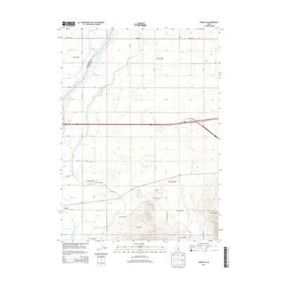
2013 Map of Rupert SE
USGS Topo · Published 2013About this map
The Snake River winds across the high desert border of Minidoka and Cassia Counties, serving as the primary pulse for an intricate network of agricultural irrigation. The town of Declo sits at the southwestern corner of this survey, a focal point for local transport and commerce where E Main St meets the rural grid. The landscape is defined by the sophisticated plumbing of the high plains, featuring a dense system of waterways including the Main South Side Canal, the Declo-Drain, and numerous laterals like the B 1 Lateral and J 2 Lateral. This complex drainage and canal system illustrates the transformation of the arid Snake River Plain into productive farmland.
Find a feature on this map
52 named features on this map. Tap any name to fly to it.
Don’t see what you’re looking for? This feature index may not catch every label — zoom into the map to look around manually.
Map Details
Editions of this 2013 Rupert SE Map
This is the sole edition of this map. No revisions or reprints were ever made.
Other maps of this area

1954 · Pocatello
USGS Topo · 1:250,000

1958 · Pocatello
USGS Topo · 1:250,000

1959 · Lake Walcott
USGS Topo · 1:62,500

1964 · Rupert SE
USGS Topo · 1:24,000

1964 · View
USGS Topo · 1:24,000

1964 · Rupert NW
USGS Topo · 1:24,000

1964 · Acequia
USGS Topo · 1:24,000

1964 · Rupert SW
USGS Topo · 1:24,000

1968 · Idahome
USGS Topo · 1:24,000

1968 · Albion
USGS Topo · 1:24,000