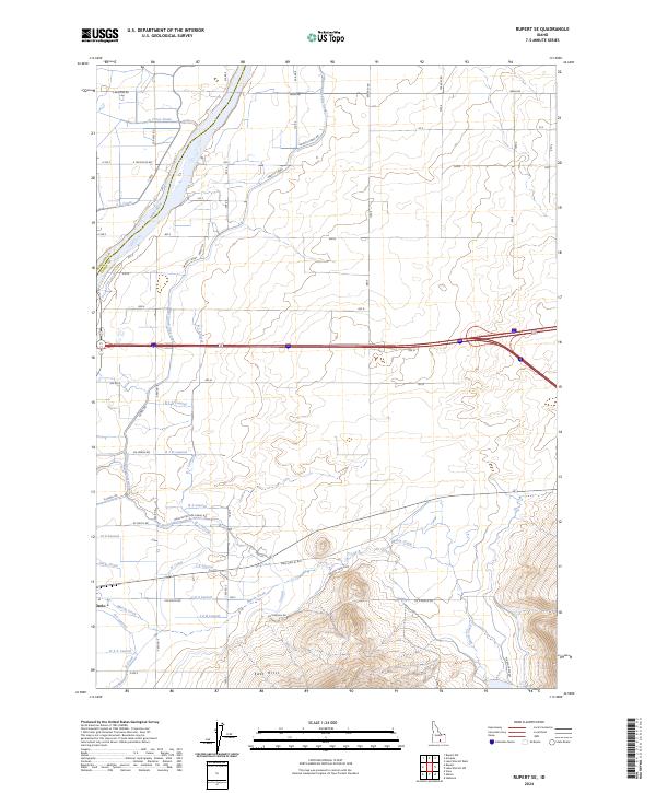
2024 Map of Rupert SE
USGS Topo · Published 2024About this map
Snake River waters define the northwestern corner of this landscape, where the Minidoka and Cassia county lines meet. The terrain is characterized by an extensive irrigation network supporting the agricultural lands around Declo. This complex system of water management includes the Main South Side Canal, the Gravity Canal, and numerous lateral branches such as the B 1 Lateral and H Lateral. These man-made waterways contrast with the natural drainage of Marsh Creek, which flows through the southern portion of the quadrangle.
Find a feature on this map
55 named features on this map. Tap any name to fly to it.
Don’t see what you’re looking for? This feature index may not catch every label — zoom into the map to look around manually.
Map Details
Editions of this 2024 Rupert SE Map
This is the sole edition of this map. No revisions or reprints were ever made.
Other maps of this area

1954 · Pocatello
USGS Topo · 1:250,000

1958 · Pocatello
USGS Topo · 1:250,000

1959 · Lake Walcott
USGS Topo · 1:62,500

1964 · Rupert SE
USGS Topo · 1:24,000

1964 · View
USGS Topo · 1:24,000

1964 · Rupert NW
USGS Topo · 1:24,000

1964 · Acequia
USGS Topo · 1:24,000

1964 · Rupert SW
USGS Topo · 1:24,000

1968 · Idahome
USGS Topo · 1:24,000

1968 · Albion
USGS Topo · 1:24,000