
1964 Map of Rupert SE
USGS Topo · Published 1965About this map
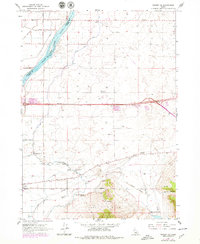
Declo stands as the primary hub in this mid-1960s agricultural landscape, where the High Sch and local road networks like Baseline Road and 200 South Road anchor the community. The region's character is defined by a massive irrigation infrastructure, drawing from the Snake River Milner Lake and distributed through a complex system of waterways including the Main Canal, Side Canal, and F Waste Canal.
Find a feature on this map
37 named features on this map. Tap any name to fly to it.
Don’t see what you’re looking for? This feature index may not catch every label — zoom into the map to look around manually.
Map Details
Editions of this 1964 Rupert SE Map
2 editions found
Other maps of this area

1954 · Pocatello
USGS Topo · 1:250,000

1958 · Pocatello
USGS Topo · 1:250,000

1959 · Lake Walcott
USGS Topo · 1:62,500

1964 · View
USGS Topo · 1:24,000

1964 · Rupert NW
USGS Topo · 1:24,000

1964 · Acequia
USGS Topo · 1:24,000

1964 · Rupert SW
USGS Topo · 1:24,000

1968 · Idahome
USGS Topo · 1:24,000

1968 · Albion
USGS Topo · 1:24,000
1984 · Lake Walcott West
USGS Topo · 1:24,000