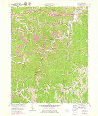
1971 Map of Rush
USGS Topo · Published 1979About this map
Industrial activity and small valley settlements define this portion of the Kentucky coalfields along the Boyd and Carter County line. The landscape is heavily marked by numerous strip mines and quarries that follow the ridgelines above narrow creek bottoms. The Chesapeake and Ohio railroad corridor serves as the primary artery for the region, connecting the communities of Coalton, Kilgore, and Rush. Local social geography is preserved through several family and community landmarks, such as Cooksey Cem, Ross Chapel, and the Star Sch located near the headwaters of Star Creek. Further south, the map details the rural clusters of Denton and Music along the winding course of Williams Creek. The interplay between the industrial extractive economy and these established hamlets provides a clear view of Appalachian life during the 1970s.
Find a feature on this map
47 named features on this map. Tap any name to fly to it.
Don’t see what you’re looking for? This feature index may not catch every label — zoom into the map to look around manually.
Map Details
Editions of this 1971 Rush Map
2 editions found
Other maps of this area

1901 · Ceredo
USGS Topo · 1:62,500

1903 · Kenova
USGS Topo · 1:125,000

1904 · Kenova
USGS Topo · 1:125,000

1911 · Louisa
USGS Topo · 1:48,000

1913 · Ceredo
USGS Topo · 1:62,500

1913 · Louisa
USGS Topo · 1:62,500

1939 · Louisa
USGS Topo · 1:62,500

1953 · Grayson
USGS Topo · 1:24,000

1953 · Oldtown
USGS Topo · 1:24,000

1953 · Rush
USGS Topo · 1:24,000