
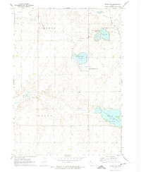
1971 Map of Rush Lake East
USGS Topo · Published 1973About this map
Rush Lake State Wildlife Management Area anchors this 1971 study of the Iowa prairie, located where the Palo Alto and Pocahontas county line divides the landscape. The map reveals a region defined by its complex hydrology and early drainage efforts, visible in the engineered pathways of Ditch No. 62 and Ditch No. 36. These man-made channels contrast with the meandering courses of the North Branch Lizard Creek and Pilot Creek.
Find a feature on this map
17 named features on this map. Tap any name to fly to it.
Don’t see what you’re looking for? This feature index may not catch every label — zoom into the map to look around manually.
Map Details
Editions of this 1971 Rush Lake East Map
This is the sole edition of this map. No revisions or reprints were ever made.
Other maps of this area

1954 · Fairmont
USGS Topo · 1:250,000

1954 · Fort Dodge
USGS Topo · 1:250,000

1957 · Fort Dodge
USGS Topo · 1:250,000

1958 · Fort Dodge
USGS Topo · 1:250,000

1958 · Fairmont
USGS Topo · 1:250,000

1971 · Albert City
USGS Topo · 1:24,000

1971 · Rush Lake West
USGS Topo · 1:24,000

1971 · Laurens
USGS Topo · 1:24,000

1972 · Ayrshire
USGS Topo · 1:24,000
1972 · Silver Lake
USGS Topo · 1:24,000