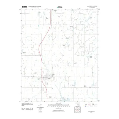
2010 Map of Rush Springs
USGS Topo · Published 2010About this map
Rush Springs serves as the central hub for this Grady County region, situated at the intersection of Hwy 17 and the US Hwy 81 Bus corridor. The landscape is defined by an extensive water management system, characterized by numerous watershed dams and reservoirs along several creek branches. Significant infrastructure includes Little Washita Site 9 Dam and Roaring Creek Site 104 Dam, which moderate the flow of Latheran Creek and Roaring Creek as they drain toward the south.
Find a feature on this map
43 named features on this map. Tap any name to fly to it.
Don’t see what you’re looking for? This feature index may not catch every label — zoom into the map to look around manually.
Map Details
Editions of this 2010 Rush Springs Map
This is the sole edition of this map. No revisions or reprints were ever made.
Other maps of this area

1902 · Rush Springs
USGS Topo · 1:125,000

1949 · Cement
USGS Topo · 1:62,500

1949 · Nellie
USGS Topo · 1:62,500

1949 · Rush Springs
USGS Topo · 1:62,500

1950 · Rush Springs
USGS Topo · 1:62,500

1950 · Marlow
USGS Topo · 1:62,500

1951 · Marlow
USGS Topo · 1:62,500

1955 · Lawton
USGS Topo · 1:250,000

1956 · Laverty
USGS Topo · 1:24,000
1956 · Rocky Ford
USGS Topo · 1:24,000