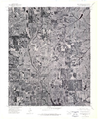
1975 Map of Rush Springs SW
USGS Topo · Published 1976About this map
Rush Springs serves as the focal point of this 1970s orthophotoquad, which uses aerial imagery to reveal the agricultural and residential patterns of this portion of Grady County. The town site is clearly visible in the southern portion of the sheet, defined by its organized street grid and surrounding farm lots. This specific type of survey provides a literal look at the landscape as it appeared in mid-February 1975, capturing the texture of the fields, wooded creek beds, and rural road networks before modern development. Because it is an orthophotograph rather than a traditional line-and-symbol map, it offers unique value for researchers looking to identify specific building locations, farmstead layouts, and land use that standard topographic maps might generalize.
Find a feature on this map
1 named feature on this map. Tap any name to fly to it.
Don’t see what you’re looking for? This feature index may not catch every label — zoom into the map to look around manually.
Map Details
Editions of this 1975 Rush Springs SW Map
This is the sole edition of this map. No revisions or reprints were ever made.
Other maps of this area

1902 · Rush Springs
USGS Topo · 1:125,000

1949 · Cement
USGS Topo · 1:62,500

1949 · Nellie
USGS Topo · 1:62,500

1949 · Rush Springs
USGS Topo · 1:62,500

1950 · Rush Springs
USGS Topo · 1:62,500

1950 · Marlow
USGS Topo · 1:62,500

1951 · Marlow
USGS Topo · 1:62,500

1955 · Lawton
USGS Topo · 1:250,000

1956 · Laverty
USGS Topo · 1:24,000
1956 · Rocky Ford
USGS Topo · 1:24,000