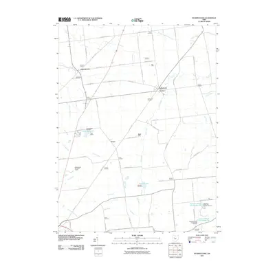
2010 Map of Rushsylvania
USGS Topo · Published 2010About this map
Rushsylvania and Northwood anchor this Logan County landscape, where headwater tributaries of the Mad River and the South Fork Great Miami River begin their drainage. The map reveals a high concentration of burial grounds, including the McKirahan Cemetery, Fulton Cemetery, and Jasinsky Cemetery, providing a significant record for genealogical research. The region is marked by its water features, such as the Appleseed Ridge Lake Number One and Appleseed Ridge Lake Number Two in the south, and the recreational grounds at Camp Wesley and Mountain Lake Camp near Rushcreek Lake. Transportation and logistics are represented by the Rushsylvania Post Office and the Bellefontaine Municipal Airport, while the network of county highways and township roads connects small settlements like Harper and Marl City across the agricultural terrain.
Find a feature on this map
69 named features on this map. Tap any name to fly to it.
Don’t see what you’re looking for? This feature index may not catch every label — zoom into the map to look around manually.
Map Details
Editions of this 2010 Rushsylvania Map
This is the sole edition of this map. No revisions or reprints were ever made.
Other maps of this area

1913 · Alger
USGS Topo · 1:48,000

1913 · Bellefontaine
USGS Topo · 1:48,000

1913 · East Liberty
USGS Topo · 1:62,500

1915 · Alger
USGS Topo · 1:62,500

1915 · Bellefontaine
USGS Topo · 1:62,500

1915 · East Liberty
USGS Topo · 1:62,500

1915 · Kenton
USGS Topo · 1:62,500

1943 · Alger
USGS Topo · 1:62,500

1944 · East Liberty
USGS Topo · 1:62,500

1944 · Kenton
USGS Topo · 1:62,500