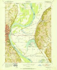
1951 Map of Rushville
USGS Topo · Published 1951About this map
The Missouri River dominates this mid-century landscape, carving wide oxbows and bends along the border of Kansas and Missouri. To the west, the city of Atchison serves as a major hub, featuring institutional landmarks like St Benedicts College, Mt Scholastic Academy, and the State Orphan Home. A unique industrial feature of the era is the U S Dept of Agriculture Natural Cooler Storage, situated near the riverbanks.
Find a feature on this map
52 named features on this map. Tap any name to fly to it.
Don’t see what you’re looking for? This feature index may not catch every label — zoom into the map to look around manually.
Map Details
Editions of this 1951 Rushville Map
2 editions found
Other maps of this area

1885 · Atchison
USGS Topo · 1:125,000

1886 · Oskaloosa
USGS Topo · 1:125,000

1888 · Oskaloosa
USGS Topo · 1:125,000

1888 · Atchison
USGS Topo · 1:125,000

1890 · Kansas City
USGS Topo · 1:125,000

1893 · Atchison
USGS Topo · 1:125,000

1894 · Kansas City
USGS Topo · 1:125,000

1894 · Oskaloosa
USGS Topo · 1:125,000

1910 · Leavenworth
USGS Topo · 1:62,500

1926 · Atchison
USGS Topo · 1:62,500