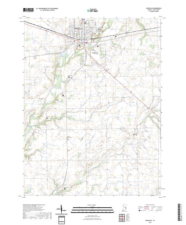
2022 Map of Rushville
USGS Topo · Published 2022About this map
Rushville serves as the central hub of this Indiana landscape, situated where the Flatrock River meanders through the northern reaches of the quadrangle. The street grid of the city, featuring historically named thoroughfares like W Market St and E Willard Ave, transitions into the smaller settlement of Circleville just to the east. This 2022 survey reveals a dense concentration of burial grounds, providing significant data for genealogical research. From the centrally located Laughlin Cem and East Hill Cem to the outlying Duke Cem and Thomas Cem, these sites are scattered across the rural township sections. The land is defined by a dendritic drainage pattern, with the Little Flatrock River and numerous tributaries like Harrigan Br and Hurricane Cr cutting through the agricultural plains of Rush County.
Find a feature on this map
98 named features on this map. Tap any name to fly to it.
Don’t see what you’re looking for? This feature index may not catch every label — zoom into the map to look around manually.
Map Details
Editions of this 2022 Rushville Map
This is the sole edition of this map. No revisions or reprints were ever made.
Other maps of this area

1942 · Columbus
USGS Topo · 1:125,000

1953 · Cincinnati
USGS Topo · 1:250,000

1957 · Cincinnati
USGS Topo · 1:250,000

1958 · Clarksburg
USGS Topo · 1:24,000

1959 · Milroy
USGS Topo · 1:24,000

1959 · Rushville
USGS Topo · 1:24,000

1959 · New Salem
USGS Topo · 1:24,000
1959 · Adams
USGS Topo · 1:24,000

1959 · Mays
USGS Topo · 1:24,000

1959 · Falmouth
USGS Topo · 1:24,000