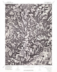
1975 Map of Rushville SE
USGS Topo · Published 1976About this map
Rushville anchors the northern boundary of this mid-1970s orthophotoquad, where the grid of town streets gives way to a sprawling patchwork of agricultural fields and wooded drainage basins. The landscape is defined by its dramatic contrast between flat upland plains and the intricate, branching ravines that carve through the Schuyler County soil. In the southern reaches, the La Moine River snakes across the terrain, its meandering path marked by dense riparian vegetation and wide floodplains. This 1975 aerial perspective provides an unfiltered look at land use patterns and rural infrastructure, capturing the exact footprint of farmsteads and timberlines before modern development altered the local geography.
Find a feature on this map
2 named features on this map. Tap any name to fly to it.
Don’t see what you’re looking for? This feature index may not catch every label — zoom into the map to look around manually.
Map Details
Editions of this 1975 Rushville SE Map
This is the sole edition of this map. No revisions or reprints were ever made.
Other maps of this area

1923 · Rushville
USGS Topo · 1:62,500

1926 · Beardstown
USGS Topo · 1:62,500

1926 · Rushville
USGS Topo · 1:62,500

1928 · Meredosia
USGS Topo · 1:62,500

1929 · Arenzville
USGS Topo · 1:62,500

1931 · Meredosia
USGS Topo · 1:62,500

1932 · Arenzville
USGS Topo · 1:62,500

1944 · Beardstown
USGS Topo · 1:62,500

1948 · Quincy
USGS Topo · 1:250,000

1956 · Quincy
USGS Topo · 1:250,000