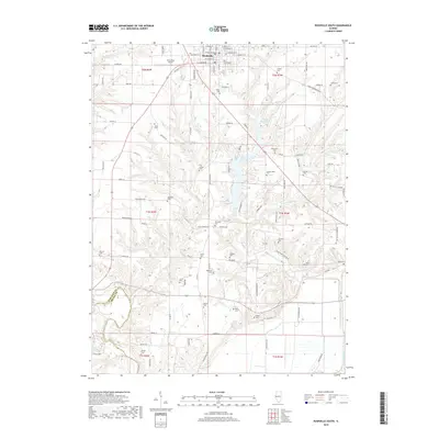
2018 Map of Rushville South
USGS Topo · Published 2018About this map
Rushville serves as the focal point for this southern Illinois region, where a dense network of family-named cemeteries suggests generations of rural settlement. The landscape is defined by the significant waters of Schuy-Rush Lake and the winding course of Crane Cr, which drains toward the southern border near the Schuyler Co and Brown Co line. For genealogists, the map is remarkably dense with burial grounds including Hardscrabble Cem, Old Lawler Cem, and Burnsides Cem, many situated on the ridges overlooking Town Br and E Fork Crane Cr. The presence of the Schuy-Rush Airport and the grid of residential streets like W Washington St and E Clinton St reflect the modern infrastructure of the county seat, while surrounding terrain remains dominated by the complex drainage basins of Horney Br and Sand Br.
Find a feature on this map
79 named features on this map. Tap any name to fly to it.
Don’t see what you’re looking for? This feature index may not catch every label — zoom into the map to look around manually.
Map Details
Editions of this 2018 Rushville South Map
This is the sole edition of this map. No revisions or reprints were ever made.
Other maps of this area

1923 · Rushville
USGS Topo · 1:62,500

1926 · Beardstown
USGS Topo · 1:62,500

1926 · Rushville
USGS Topo · 1:62,500

1928 · Meredosia
USGS Topo · 1:62,500

1929 · Arenzville
USGS Topo · 1:62,500

1931 · Meredosia
USGS Topo · 1:62,500

1932 · Arenzville
USGS Topo · 1:62,500

1944 · Beardstown
USGS Topo · 1:62,500

1948 · Quincy
USGS Topo · 1:250,000

1956 · Quincy
USGS Topo · 1:250,000