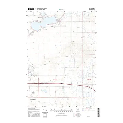
2015 Map of Rusk
USGS Topo · Published 2015About this map
The Red Cedar River flows into the expansive waters of Tainter Lake, shaping the northern landscape of this Dunn County region. In the central part of the quadrangle, the small settlement of Rusk sits at a crossroads, representing the rural residential patterns that persist outside the larger hub of Menomonie to the south. The terrain is marked by notable elevations such as Hanke Hill and significant wetland areas like Elk Mound Marsh, which dominate the eastern drainage toward Muddy Cr. This 2015 survey reveals a blend of aviation infrastructure at the Menomonie Municipal Airport-Score Field alongside historical local sites. Several burial grounds, including Potters Field Cem, Hill Grove Cem, and Cedar Falls Cem, are distributed across the township, providing essential markers for genealogical research and local history documentation in a landscape defined by its glacial hydrology.
Find a feature on this map
54 named features on this map. Tap any name to fly to it.
Don’t see what you’re looking for? This feature index may not catch every label — zoom into the map to look around manually.
Map Details
Editions of this 2015 Rusk Map
This is the sole edition of this map. No revisions or reprints were ever made.
Other maps of this area

1934 · Elk Mound
USGS Topo · 1:62,500

1936 · Elk Mound
USGS Topo · 1:62,500

1940 · Menomonie
USGS Topo · 1:62,500

1942 · Menomonie
USGS Topo · 1:62,500

1949 · New Auburn
USGS Topo · 1:62,500

1949 · Ridgeland
USGS Topo · 1:62,500

1951 · Ridgeland
USGS Topo · 1:62,500

1951 · New Auburn
USGS Topo · 1:62,500

1953 · Eau Claire
USGS Topo · 1:250,000

1953 · Rice Lake
USGS Topo · 1:250,000