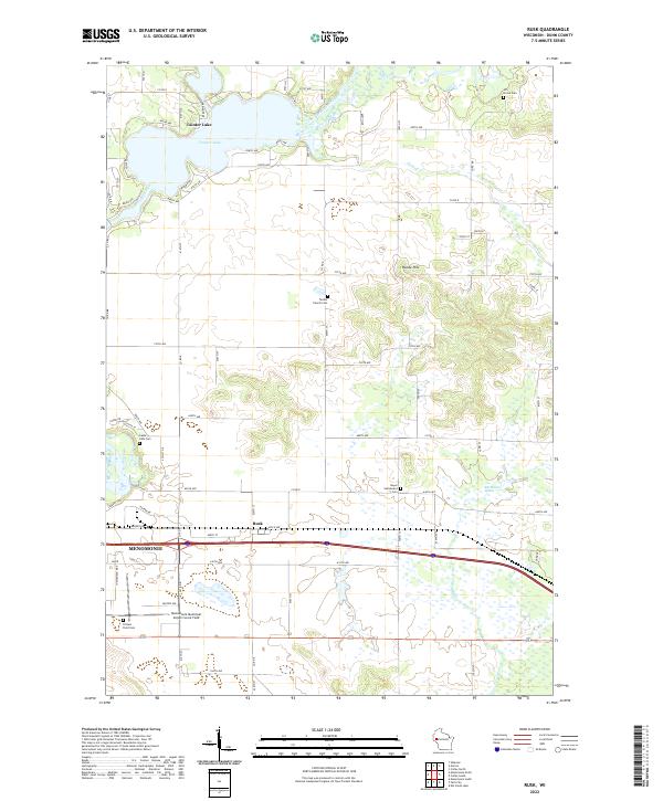
2022 Map of Rusk
USGS Topo · Published 2022About this map
Tainter Lake and the Red Cedar River define the northern hydrology of this Dunn County landscape, where rural agricultural lands meet the expanding outskirts of Menomonie. The topography is marked by notable elevations like Hanke Hill and low-lying wetlands such as the Elk Mound Marsh and Muddy Cr. For genealogists, the map is particularly rich in burial sites, documenting the Hill Grove Cem, Tainter Church Cem, and the Beyer Settlement Cem. The transition from rural to municipal use is evident near the Menomonie Municipal Airport-Score Field, while the small settlement of Rusk remains a central waypoint. A network of county roads, including Co Rd D and Co Rd E, connects these scattered cemeteries and homesteads across the townships.
Find a feature on this map
50 named features on this map. Tap any name to fly to it.
Don’t see what you’re looking for? This feature index may not catch every label — zoom into the map to look around manually.
Map Details
Editions of this 2022 Rusk Map
This is the sole edition of this map. No revisions or reprints were ever made.
Other maps of this area

1934 · Elk Mound
USGS Topo · 1:62,500

1936 · Elk Mound
USGS Topo · 1:62,500

1940 · Menomonie
USGS Topo · 1:62,500

1942 · Menomonie
USGS Topo · 1:62,500

1949 · New Auburn
USGS Topo · 1:62,500

1949 · Ridgeland
USGS Topo · 1:62,500

1951 · Ridgeland
USGS Topo · 1:62,500

1951 · New Auburn
USGS Topo · 1:62,500

1953 · Eau Claire
USGS Topo · 1:250,000

1953 · Rice Lake
USGS Topo · 1:250,000