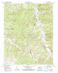
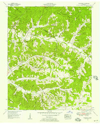
1953 Map of Ruskin
USGS Topo · Published 1991About this map
Yellow Creek carves a deep path through the middle of this Tennessee landscape, serving as a focal point for settlement and early community life. The 1953 topography, based on field work by the Tennessee Valley Authority, captures a network of rural crossroads and hollows where family lineage is etched into the land through dozens of namesake burial grounds. At Ruskin, the terrain gives way to the notable Jewel Cave, while the surrounding hills of Nubbin Ridge are dotted with small congregations such as Salmon Branch Ch and Bethany Ch. The map illustrates a transitional period in Middle Tennessee, documenting traditional landmarks like Bradford Spring alongside the evolving road networks at Adams Crossroads and Thompsons Crossroads. It is an essential document for genealogists tracing ancestors through the numerous family-named cemeteries like Balthrop Cem and Edgewood Cem.
Find a feature on this map
86 named features on this map. Tap any name to fly to it.
Don’t see what you’re looking for? This feature index may not catch every label — zoom into the map to look around manually.
Map Details
Editions of this 1953 Ruskin Map
3 editions found
Other maps of this area

1931 · Erin
USGS Topo · 1:62,500

1936 · Gorman
USGS Topo · 1:24,000

1936 · Tantrough Hollow
USGS Topo · 1:24,000

1936 · Woolworth
USGS Topo · 1:24,000

1936 · Ruskin
USGS Topo · 1:24,000

1936 · Tennessee City
USGS Topo · 1:24,000

1936 · Dickson
USGS Topo · 1:24,000
1952 · Mc Ewen
USGS Topo · 1:24,000
1952 · Woolworth
USGS Topo · 1:24,000

1953 · Dickson
USGS Topo · 1:24,000