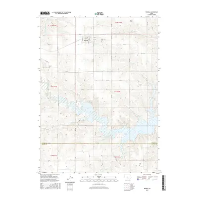
2015 Map of Russell
USGS Topo · Published 2015About this map
The town of Russell anchors this rural landscape at the intersection of several county routes, serving as a focal point for the surrounding agricultural community. The northern portion of the quadrangle is defined by the headwaters of Cedar Cr and Honey Cr, while the southern half is dominated by the sprawling waters of Rathbun Lake, an impoundment of the Chariton River. This reservoir has reshaped the local topography, creating numerous fingers and inlets that contrast with the traditional grid of rural sections. Traces of older communities and gathering points are visible through labels like Watrous, Vale, and Utah, alongside several established burial grounds including Russell Cem and the more remote Ragtown Cem. The map provides a clear view of the transition from upland prairie farms to the aquatic environment of the river valley, supplemented by local landmarks like Beck Airport.
Find a feature on this map
63 named features on this map. Tap any name to fly to it.
Don’t see what you’re looking for? This feature index may not catch every label — zoom into the map to look around manually.
Map Details
Editions of this 2015 Russell Map
This is the sole edition of this map. No revisions or reprints were ever made.
Other maps of this area

1918 · Chariton
USGS Topo · 1:62,500

1924 · Melcher
USGS Topo · 1:62,500

1934 · Humeston
USGS Topo · 1:48,000

1935 · Russell
USGS Topo · 1:62,500

1937 · Corydon
USGS Topo · 1:62,500

1938 · Russell
USGS Topo · 1:62,500

1954 · Centerville
USGS Topo · 1:250,000

1954 · Des Moines
USGS Topo · 1:250,000

1956 · Des Moines
USGS Topo · 1:250,000

1957 · Des Moines
USGS Topo · 1:250,000