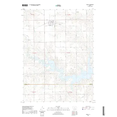
2018 Map of Russell
USGS Topo · Published 2018About this map
The town of Russell serves as the primary hub of this south-central Iowa landscape, where a grid of rural roads connects agricultural uplands with the extensive waters of Rathbun Lake. To the north and west, the terrain is defined by the drainage of Little White Breast Cr and Honey Cr, while the southeastern corner of the map is dominated by the sprawling inlets of the lake created by the damming of the Chariton River. Local history is anchored by several burial grounds including Russell Cem, Ragtown Cem, and Jones Cem, each marking the generational settlements within Lucas and Wayne counties. The map captures the intersection of traditional land use and modern infrastructure, from the small-scale Beck Airport to the intricate network of county roads like Co Rd H40 and Co Rd S50 that cross the branching waterways of Ragtown Branch and Lost Branch.
Find a feature on this map
70 named features on this map. Tap any name to fly to it.
Don’t see what you’re looking for? This feature index may not catch every label — zoom into the map to look around manually.
Map Details
Editions of this 2018 Russell Map
This is the sole edition of this map. No revisions or reprints were ever made.
Other maps of this area

1918 · Chariton
USGS Topo · 1:62,500

1924 · Melcher
USGS Topo · 1:62,500

1934 · Humeston
USGS Topo · 1:48,000

1935 · Russell
USGS Topo · 1:62,500

1937 · Corydon
USGS Topo · 1:62,500

1938 · Russell
USGS Topo · 1:62,500

1954 · Centerville
USGS Topo · 1:250,000

1954 · Des Moines
USGS Topo · 1:250,000

1956 · Des Moines
USGS Topo · 1:250,000

1957 · Des Moines
USGS Topo · 1:250,000