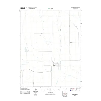
2012 Map of Russell Springs
USGS Topo · Published 2012About this map
Russell Springs sits along the southern bank of the Smoky Hill River in this western Kansas landscape. The settlement is organized around a traditional grid featuring Broadway St and Kansas avenue, surrounded by the open high Plains. The drainage of the area is defined by the convergence of W Spring Cr and E Spring Cr, which flow southward to meet the river. Located just northwest of the town center, the Russell Springs Cem serves as a primary point of interest for genealogists and local historians tracing the heritage of Logan County. The surrounding land is partitioned by a strictly rectangular road network with historical names such as Navajo, Seneca, and Ute, reflecting the early survey patterns that shaped the expansion of rural Kansas.
Find a feature on this map
22 named features on this map. Tap any name to fly to it.
Don’t see what you’re looking for? This feature index may not catch every label — zoom into the map to look around manually.
Map Details
Editions of this 2012 Russell Springs Map
This is the sole edition of this map. No revisions or reprints were ever made.
Other maps of this area

1954 · Goodland
USGS Topo · 1:250,000

1955 · Scott City
USGS Topo · 1:250,000

1956 · Goodland
USGS Topo · 1:250,000

1957 · Goodland
USGS Topo · 1:250,000

1958 · Scott City
USGS Topo · 1:250,000

1969 · Mc Allaster SE
USGS Topo · 1:24,000

1969 · Russell Springs 2 NE
USGS Topo · 1:24,000

1969 · Russell Springs 2 SE
USGS Topo · 1:24,000

1972 · Russell Springs
USGS Topo · 1:24,000

1972 · Monument
USGS Topo · 1:24,000