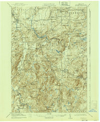
1918 Map of Russell
USGS Topo · Published 1940About this map
The Grass River winds through the heart of this St. Lawrence County landscape, defining a rural network of corner settlements and district schools just before the 1920s. This survey, conducted by R.B. Marshall and his team, reveals a region transitioning from early industrial efforts to a more established agricultural and forest-based economy. The presence of the Clifton Furnace (Ruins) near the Frobed Ponds serves as a tangible link to the area's iron-smelting past, while dozens of named schoolhouses like the Pestle Street School and Bush Hill School illustrate the density of the rural population at the time.
Find a feature on this map
99 named features on this map. Tap any name to fly to it.
Don’t see what you’re looking for? This feature index may not catch every label — zoom into the map to look around manually.
Map Details
Editions of this 1918 Russell Map
5 editions found

Other maps of this area

1904 · Ogdensburg
USGS Topo · 1:62,500

1905 · Ogdensburg
USGS Topo · 1:62,500

1908 · Potsdam
USGS Topo · 1:62,500

1910 · Canton
USGS Topo · 1:62,500

1911 · Canton
USGS Topo · 1:62,500

1913 · Lake Bonaparte
USGS Topo · 1:62,500

1915 · Gouverneur
USGS Topo · 1:62,500

1915 · Russell
USGS Topo · 1:62,500

1916 · Lake Bonaparte
USGS Topo · 1:62,500

1916 · Oswegatchie
USGS Topo · 1:62,500